If you manage large civil engineering projects, you know the scenario well: the end of the month arrives, and the earthworks subcontractor’s invoice lands on your desk. The contractor charges for moving 15,000 m³ of soil (cut and fill). However, your visual report and traditional spot-check surveying indicate something closer to 12,000 m³.
The construction site is a living, chaotic organism, and the lack of exact visibility over physical progress generates cash flow delays and inaccurate billing disputes with subcontractors. Who is right? Do you pay the difference to avoid halting the project, or do you delay the schedule to redo the manual survey?
This chronic discrepancy doesn’t just ruin the team’s mood; it erodes the project’s profit margin. The definitive solution to this financial bottleneck is called the Digital Twin, generated by drones.
In this article, Horus Smart Detections explains how to transform the airspace of your construction site into a millimeter-precision tool, ensuring fair payments and foolproof physical-financial tracking.
Traditional Surveying and the “Acceptable” Margin of Error
For decades, earthmoving control and material stockpile management relied on traditional surveying (using a total station or mobile RTK GPS). Although it is an exact science, in the daily practice of massive construction sites, manual earthworks measurements are slow and limited to specific points.
A surveyor on the ground must physically walk over piles of gravel, sand, or steep embankments. Due to time constraints and safety risks, the professional collects points by sampling, and the software calculates an estimate of that volume. The paper schedule rarely matches physical reality, creating loopholes for subcontractors to charge for larger volumes than actually executed, capitalizing on the margin of error.
What is the Construction Digital Twin?
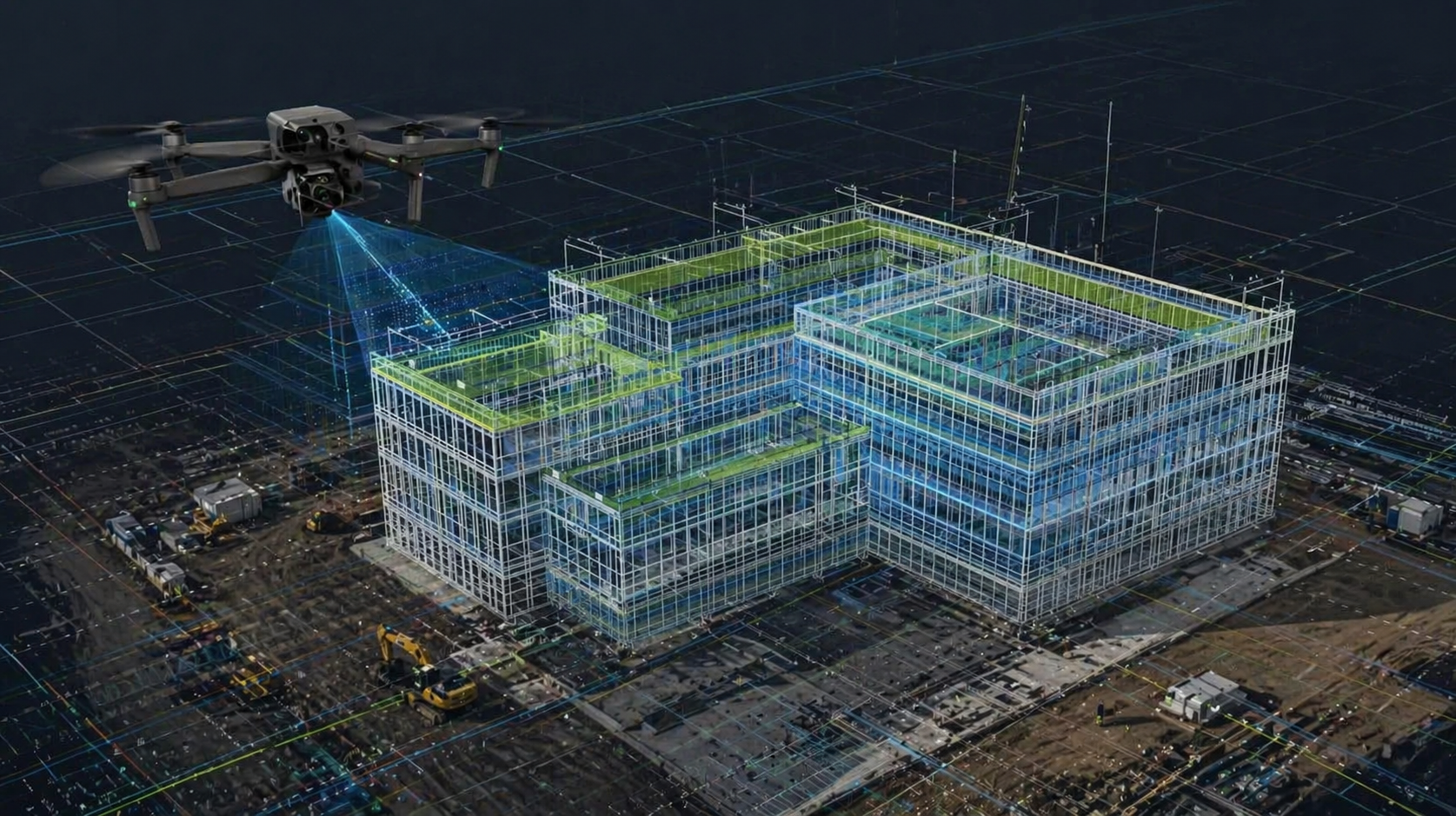
The Digital Twin is the virtualization of reality. Through automated drone flights (such as the DJI Enterprise line) integrated with cutting-edge technology, we transform simple aerial photos into measurable 3D models—namely, Point Clouds and Orthomosaics.
This means you don’t just receive a panoramic video to post on social media. You receive a three-dimensional replica of your job site right on your computer screen, where every pixel has exact latitude, longitude, and elevation coordinates (X, Y, Z).
Instant Volumetrics: Paying for the Real Data
The great revolution for the Project Manager happens at the moment of measurement approvals (billing authorization).
If you need to measure a stockpile of aggregate or the exact cut and fill volume, the process goes from taking days to being instantaneous:
- The drone performs an autonomous mapping of the site.
- The data is uploaded to the Horus Monitora Platform.
- With two clicks on the platform, you draw a polygon over the desired material pile, and the Artificial Intelligence calculates the exact volume in cubic meters (m³).
The result? The end of measurement disputes with suppliers. Against the mathematical data of a dense point cloud, there is no argument. Your company starts authorizing subcontractor payments based on real, irrefutable data, not estimates.
Beyond Volume: BIM Integration and Legal Protection
The utility of a Digital Twin extends far beyond aggregate control and earthmoving. The technology acts as a legal shield for your construction company.
- Physical-Financial Tracking with BIM: Advanced processing software allows you to overlay the updated 3D drone model directly onto the original BIM (Building Information Modeling) design (planned vs. as-built). If Pillar 14 was scheduled to be poured today and it isn’t, the system itself flags the schedule deviation.
- The Construction “Time Machine” (Visual History): How often does a technical or legal dispute arise months after a phase is completed? “What did this foundation look like before the concrete was poured?” With the Digital Twin, you access the exact timeline of that date and prove proper execution in the event of future litigation with the client or supplier.
Predictability in an Unpredictable Environment
Tracking the physical progress of large projects requires constant, and often dangerous, site visits. By adopting the Digital Twin, you remove your engineering team from the risks of uneven terrain and place them in the strategic position of data analysis.
Ending measurement disputes is not just a way to avoid headaches; it is a direct strategy to protect your cash flow. By paying exactly for what was moved, the ROI (Return on Investment) of the Horus processing software usually pays for itself on the very first adjusted invoice.
Bring your construction site into the 21st century. Contact the Horus Smart Detections team and learn how to transform your physical job site into measurable digital data, reducing rework and financial losses.